
🪪 The six islands at a glance
📍 Where they are
The six islands are scattered across the Aegean. Folegandros and Amorgos are in the Cyclades, one west of Santorini and the other east of Naxos. Symi and Karpathos are in the Dodecanese, the first next to Rhodes and the second between Rhodes and Crete. Kythira lies south of the Peloponnese, and Ikaria is in the north-eastern Aegean, next to Samos.
📍 Where the six islands are
The six islands are shown in red: Folegandros and Amorgos in the Cyclades, Symi and Karpathos in the Dodecanese, Kythira south of the Peloponnese and Ikaria in the north-eastern Aegean. They are far apart: choose one or two for each trip.
🧭 Which island suits you
Don’t try to see them all together: they are far from each other. Combine Folegandros with Milos or Santorini, Amorgos with Naxos, Symi with Rhodes. Karpathos, Kythira and Ikaria need a trip of their own. Here is how they differ:
| Island | How to get there | What it has | For whom |
|---|---|---|---|
| Folegandros | Ferry from Piraeus | A Chora on a cliff, footpaths, beaches reached by boat | Couples, peace and quiet |
| Amorgos | Ferry from Piraeus | Hozoviotissa, footpaths, deep blue water | Hikers, nature lovers |
| Symi | Small boat from Rhodes | A neoclassical harbour, Panormitis | A day trip from Rhodes, photography |
| Karpathos | Plane or a long ferry ride | Olympos, wild beaches, wind | Tradition, windsurfing, nature |
| Kythira | Plane or ferry from Neapoli | A castle, waterfalls, green ravines | Families, driving, peace and quiet |
| Ikaria | Plane or ferry from Piraeus | Festivals, hot springs, wild coasts | A slow pace, partying |
👍 Why go
- Fewer people, even in August.
- Authentic villages where life doesn’t revolve only around tourism.
- Lots of footpaths and wild nature.
- A calmer atmosphere and friendlier prices than the famous islands.
👎 What to know
- The journeys are long and there are fewer connections.
- In strong winds, ferries may be delayed or cancelled.
- Few places to stay: book early for July and August.
- Less organised: you need a car or good legs.
🏛️ Folegandros: the Chora on the cliff
Folegandros is a small, dry island in the Cyclades with one of the most beautiful Choras in the Aegean. The Chora is built on the edge of a cliff, high above the sea, with little tree-filled squares and the old Kastro, where the houses form a wall. A zigzag path climbs from the Chora to the church of the Panagia, with views over the whole island, ideally at sunset.
The beaches are few and quiet: some you reach by small boat, like Katergo, and others on foot, like Livadaki. Ano Meria is a scattered farming village in the west. Ferries arrive from Piraeus, often via Milos or Santorini.
🗺️ Folegandros
A small, long island: the port, Karavostasis, in the east, the Chora in the middle on the cliff, and Ano Meria in the west. Tap each number to see what it is.
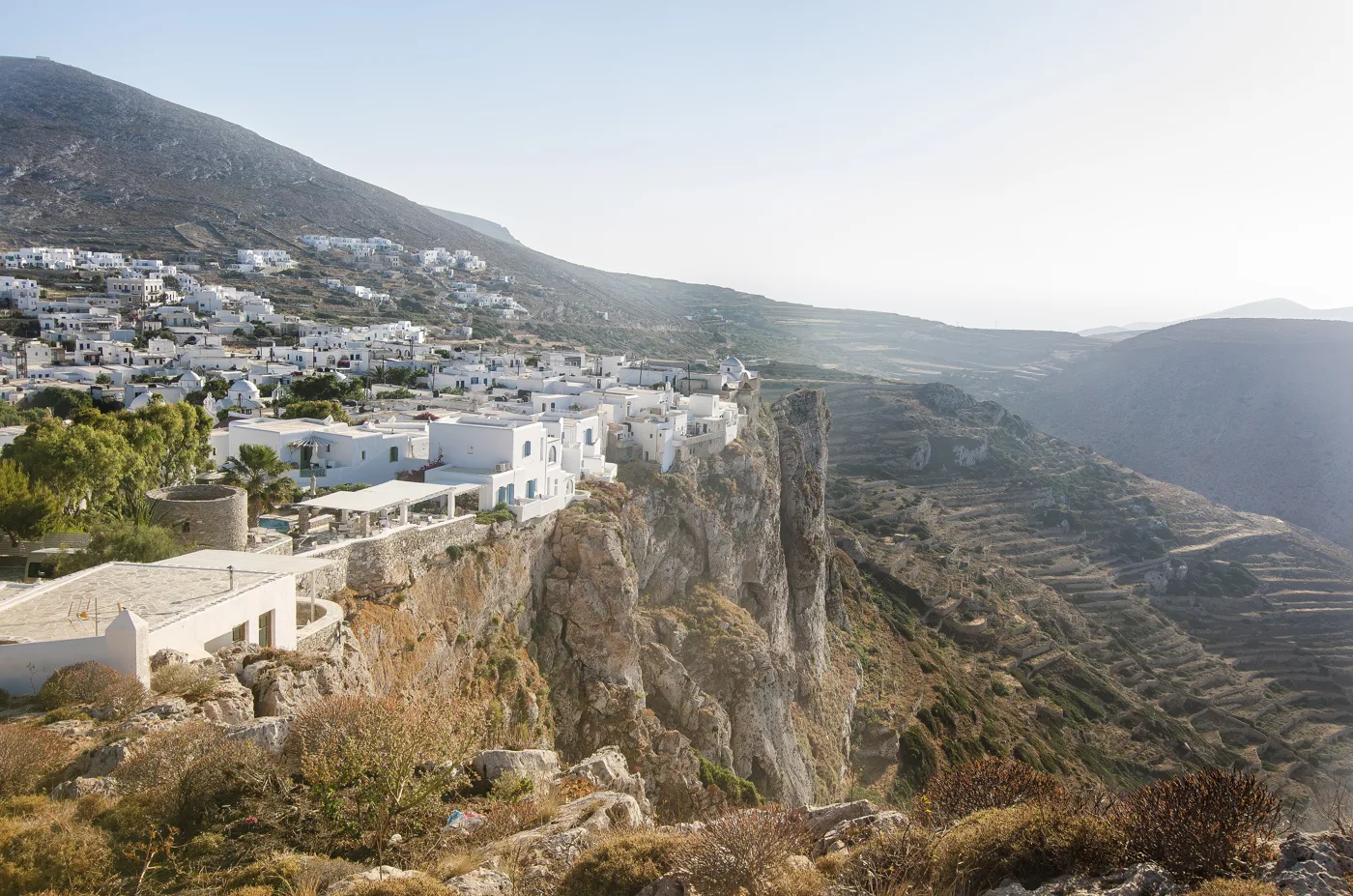
On the edge of the cliff.
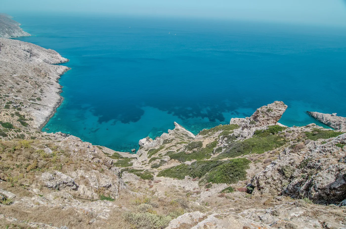
Cliffs and clear water.
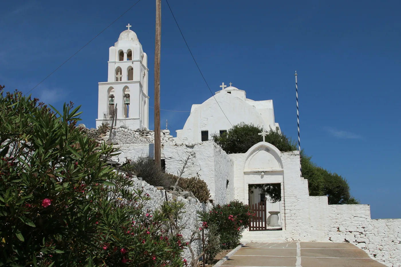
The path above the Chora.
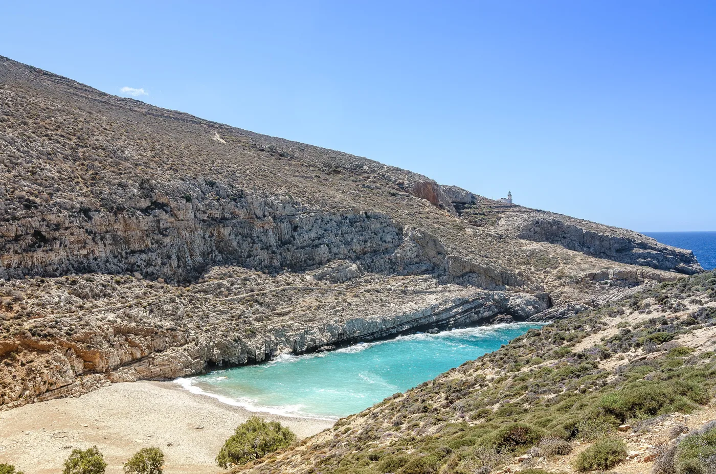
A beach in a narrow cove.
Photos: Etienne O. Dallaire (CC BY 4.0), Zde (CC BY-SA 4.0) · Wikimedia Commons
⛪ Amorgos: the monastery in the rock
Amorgos is the easternmost island of the Cyclades: long and mountainous, with a deep blue sea made famous by Luc Besson’s film The Big Blue, which was shot here. Its symbol is the Monastery of Hozoviotissa, a white 11th-century monastery clinging to a sheer rock face about 300 metres above the sea. You walk up hundreds of steps: dress modestly, with long trousers or skirts and covered shoulders.
The Chora, with windmills and white lanes, lies above the port of Katapola. In the north, Aegiali has a sandy beach and mountain villages such as Langada and Tholaria. In the south, near Kalotaritissa, is the wreck of the Olympia from the film. Amorgos is ideal for hiking, with old footpaths linking the villages.
🗺️ Amorgos
Amorgos is long and narrow, with two ports: Katapola in the middle and Aegiali in the north. The Chora and Hozoviotissa are above Katapola, and Kalotaritissa is in the south.
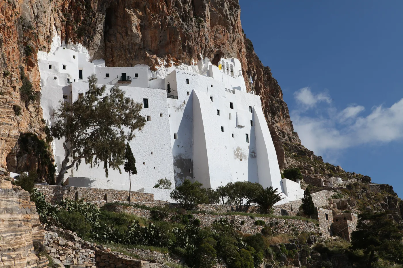
Clinging to the rock, above the sea.
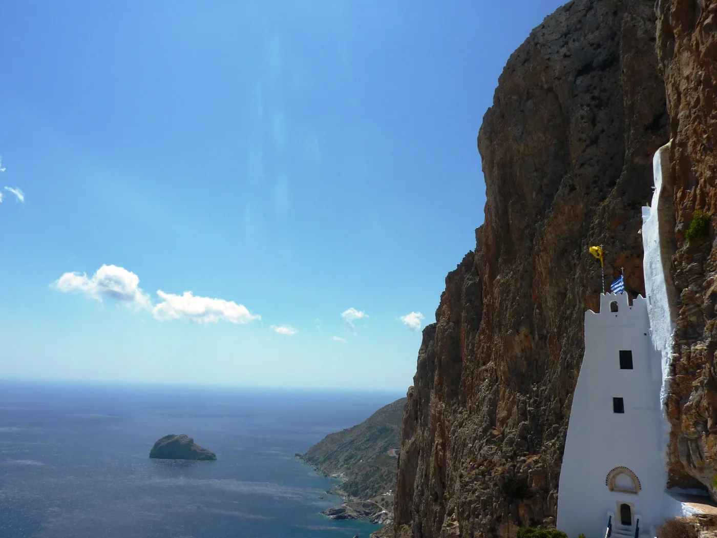
The view from the steps.
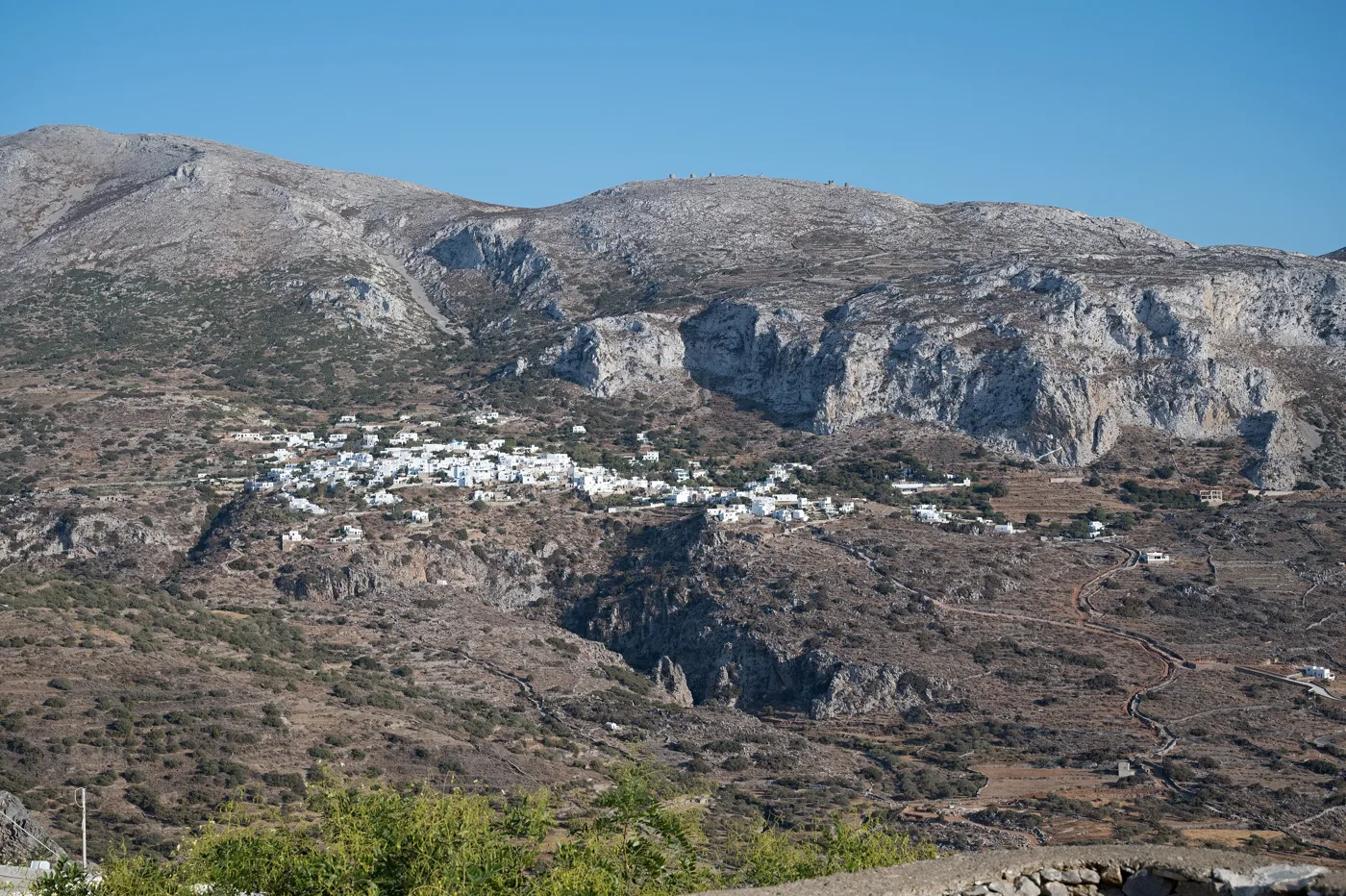
A village below the mountains of Aegiali.
Photos: Apenauta (Public domain), Chris Kar (CC BY-SA 4.0), Zde (CC BY-SA 4.0) · Wikimedia Commons
🎨 Symi: the neoclassical harbour
Symi is a small, rocky island in the Dodecanese, very close to Rhodes and the coast of Turkey. As the boat enters the harbour, Gialos, you see hundreds of neoclassical houses in ochre, pink and blue rising like an amphitheatre up the hills. They were built when the island grew rich from sponges and ships. From Gialos, the Kali Strata, a long stairway, climbs up to Chorio, the upper town.
In the south, in an enclosed bay, is the large Monastery of the Archangel Michael of Panormitis, with a tall, ornate bell tower, visited by many pilgrims. Symi works as a day trip from Rhodes, but it is worth staying a night, when the day boats have left and the harbour goes quiet.
🗺️ Symi
The harbour, Gialos, is in the north, and Panormitis Monastery is in an enclosed bay in the south. Many boats from Rhodes stop at both.
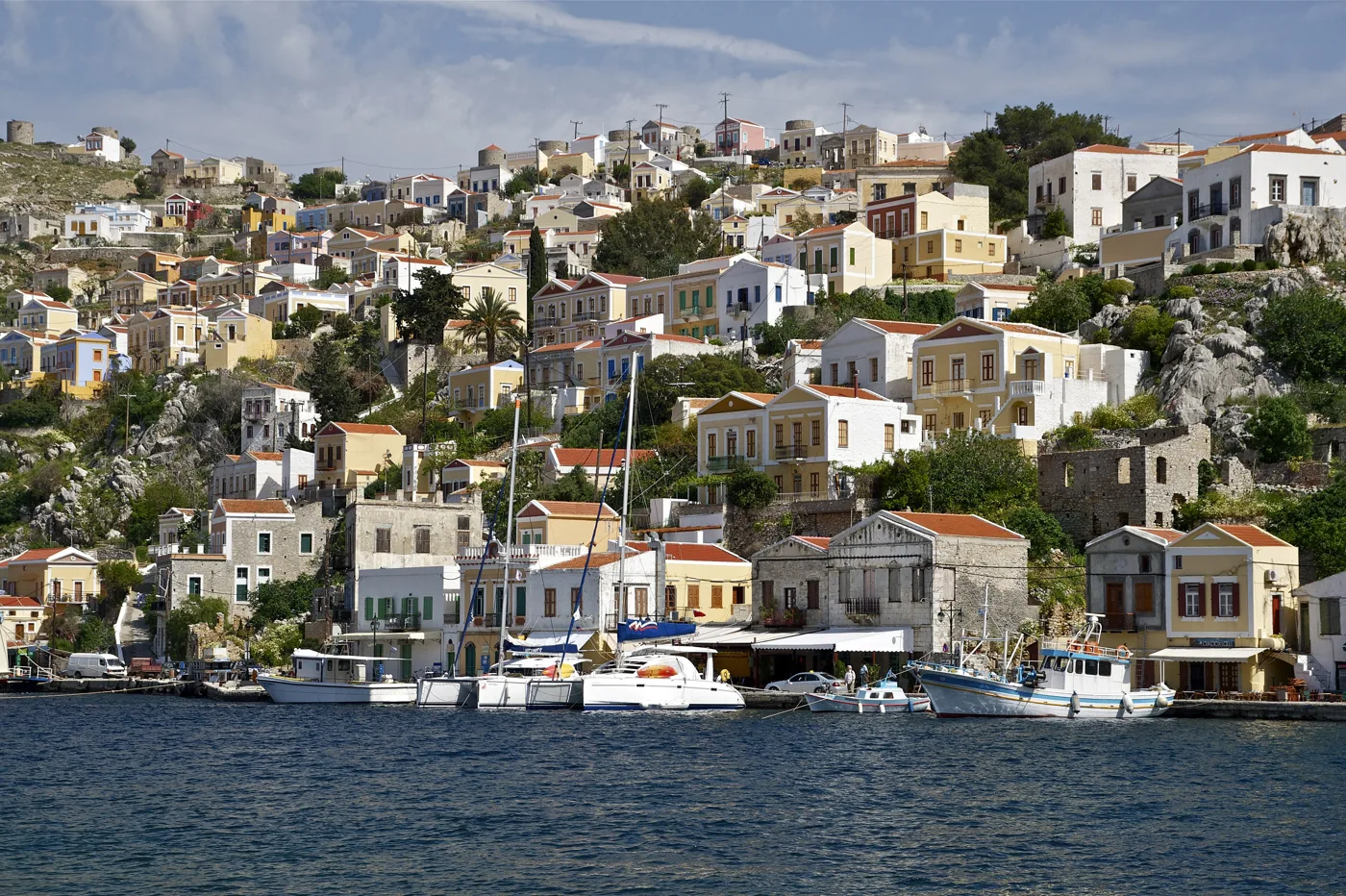
Neoclassical houses in an amphitheatre.
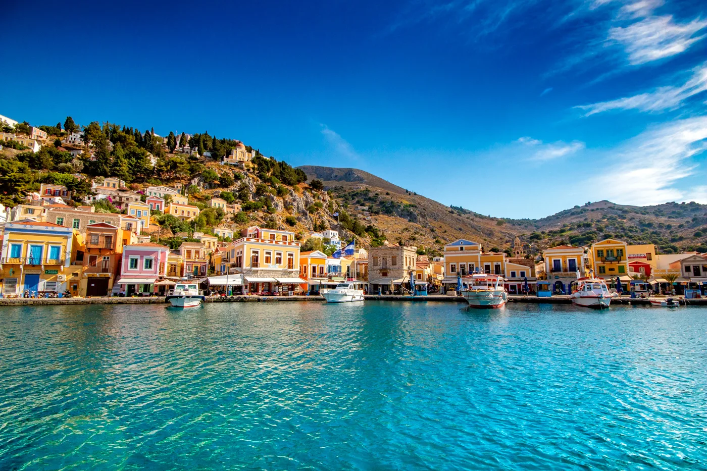
One of the most beautiful in Greece.
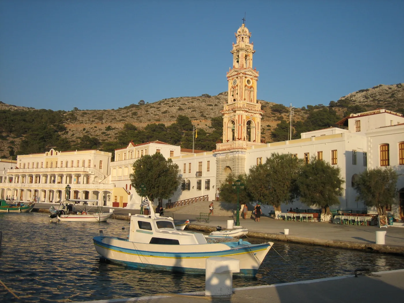
The great monastery of the Archangel Michael.
Photos: Jebulon (CC0), SymiArt (CC BY-SA 4.0), npinikas (CC BY 3.0) · Wikimedia Commons
🌬️ Karpathos: Olympos and the wind
Karpathos is a long, mountainous island between Rhodes and Crete. In the north, Olympos is a village built on a ridge, with colourful houses and old windmills. Because it stayed isolated for centuries, it kept its own dialect and traditional costumes, which some older women still wear. You get there by car on a mountain road, or by boat to Diafani and then by bus.
Pigadia, in the south-east, is the capital and the port. On the east coast you will find some of the most beautiful beaches in the Dodecanese, such as Apella, with pine trees and turquoise water. Karpathos is very windy, and the south is a well-known spot for windsurfing and kitesurfing. Opposite Arkasa you can see little Kasos.
🗺️ Karpathos
Pigadia, the capital and port, is in the south-east. A mountain road climbs north to Olympos, above Diafani. The best beaches, such as Apella, are on the east coast.
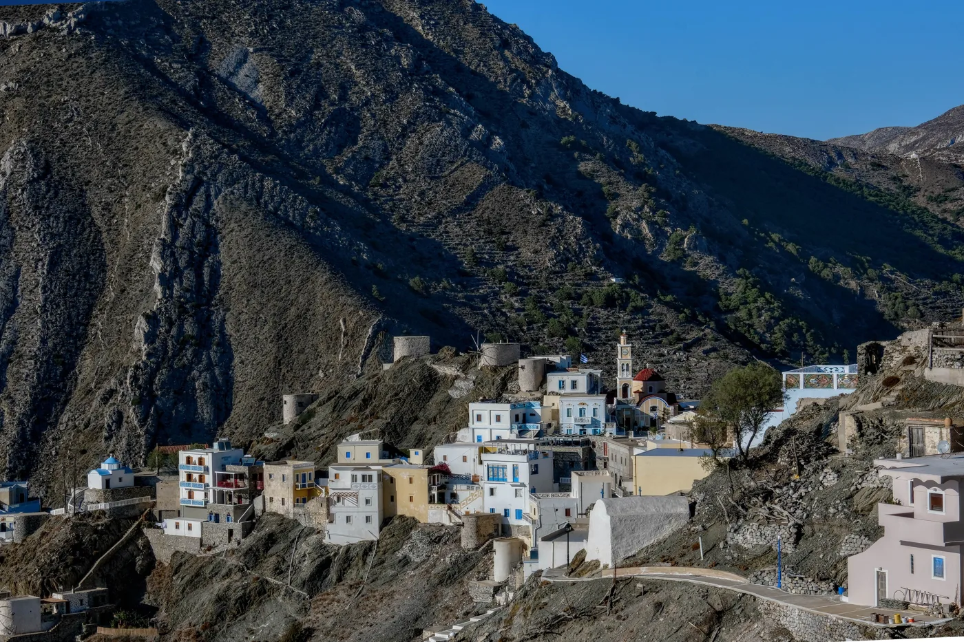
The village on the ridge.
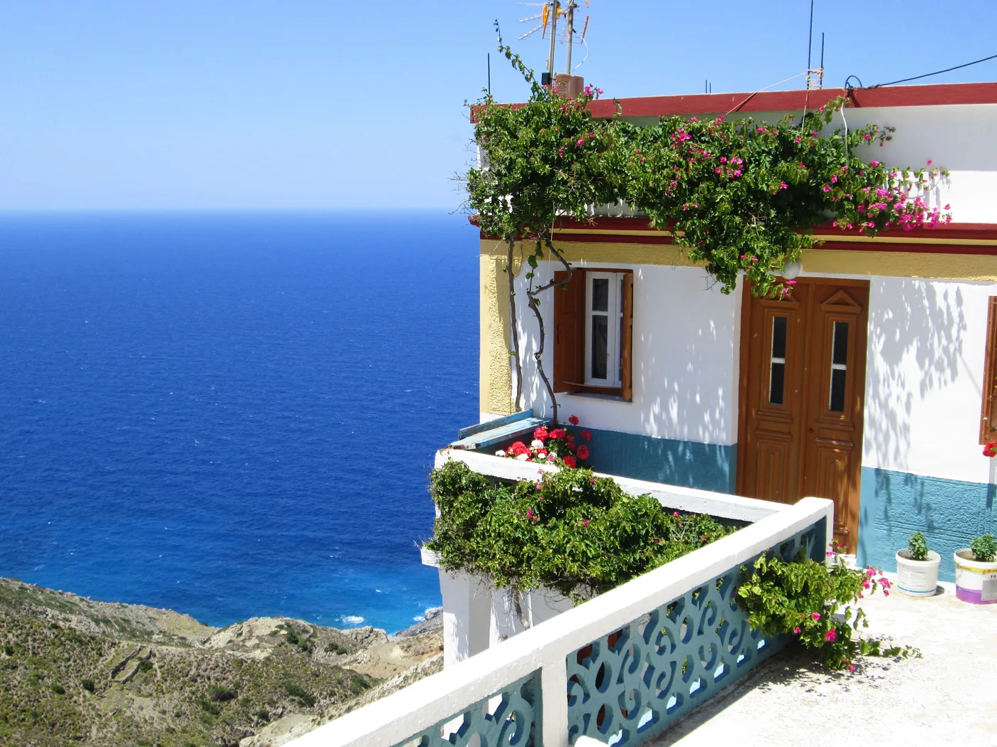
Above the Karpathian Sea.
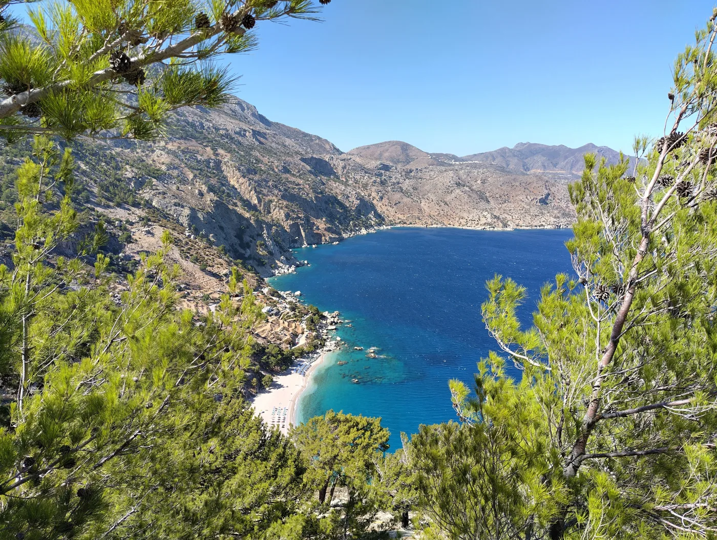
One of the island’s most beautiful beaches.
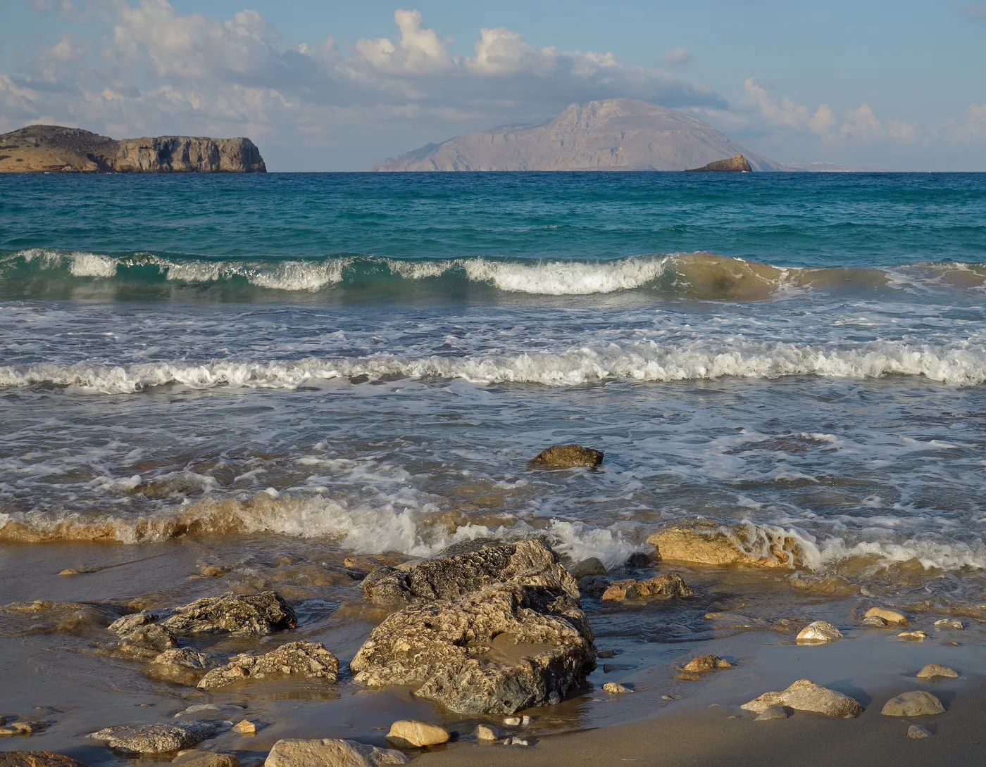
With Kasos opposite.
Photos: Magnus.chronicles (CC BY 4.0), Andrewthefourth (CC BY-SA 4.0), Tomisti (CC BY-SA 4.0), Ввласенко (CC BY-SA 3.0) · Wikimedia Commons
💧 Kythira: a castle and waterfalls
Kythira is a large island south of the Peloponnese, between the Ionian and the Aegean. Historically it belongs to the Ionian Islands, and you can see this in the houses, the churches and the Venetian castle above the Chora. Below the castle, Kapsali is a fishing village on a double bay.
Kythira is greener than you might expect: it has ravines, watermills and springs. Near the village of Mylopotamos, a path leads down to the Fonissa waterfall, which falls into a blue-green pool. The island is large and you need a car. You fly from Athens or take the ferry from Neapoli in Laconia, which arrives at Diakofti.
🗺️ Kythira
The Chora with the castle and Kapsali are at the southern tip. Mylopotamos with the waterfall is in the west, and Diakofti, the port for ferries from Neapoli, is on the east coast.
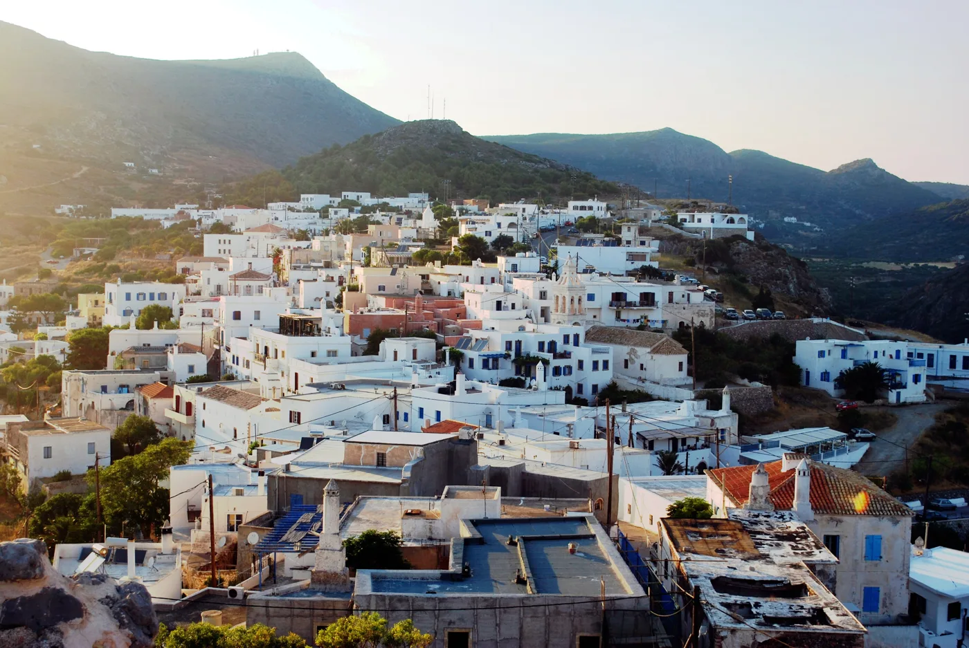
From the Venetian castle.
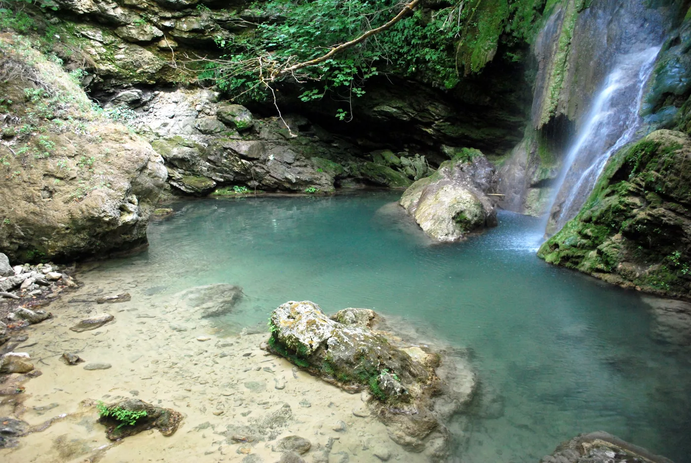
The waterfall of Mylopotamos.
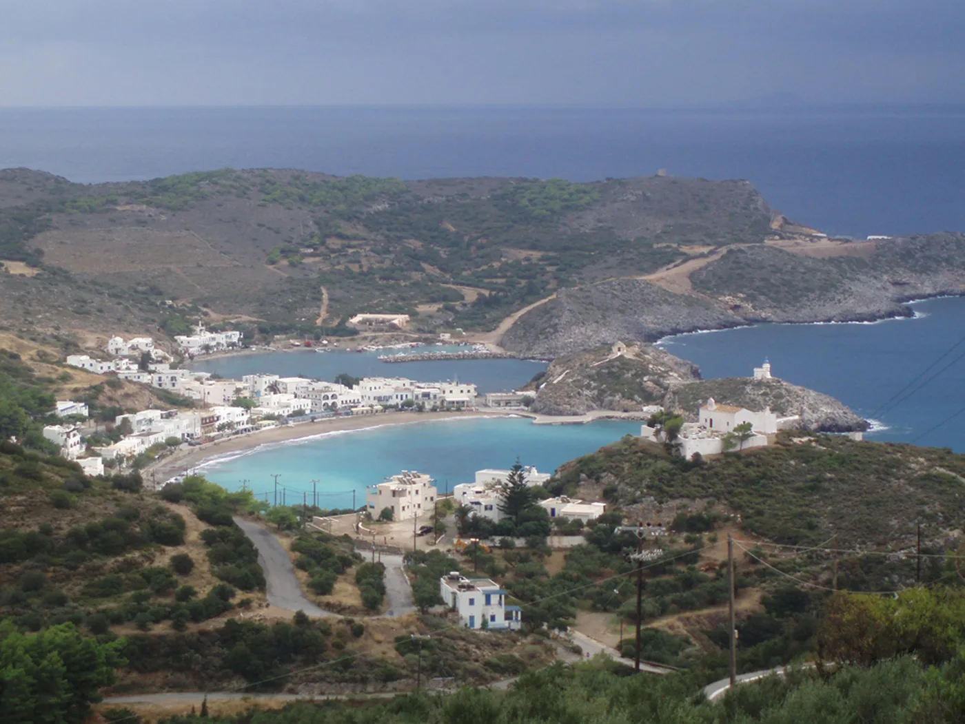
The double bay below the Chora.
Photos: Comzeradd (CC BY-SA 3.0), Ioannis Fakis (CC BY-SA 4.0) · Wikimedia Commons
🎻 Ikaria: festivals and long lives
Ikaria, in the north-eastern Aegean, takes its name, according to mythology, from Icarus, who fell into the sea nearby. It is known around the world as one of the so-called “Blue Zones”, places where many people live past ninety. Locals say the secret is simple food, walking in the mountains and a relaxed pace.
In summer the villages hold panigyria, festivals that go on until morning, with live music, Ikarian dancing and wine. On the north coast, Armenistis and Nas, with the ruins of a sanctuary of Artemis, have the best sandy beaches and sunsets. In the south, Seychelles is a cove with white rocks and turquoise water, and at Therma, next to Agios Kirykos, you will find hot springs.
🗺️ Ikaria
Ikaria has two ports: Agios Kirykos in the south, with Therma next to it, and Evdilos in the north. West of Evdilos, Armenistis and Nas have the best sandy beaches and the festivals.
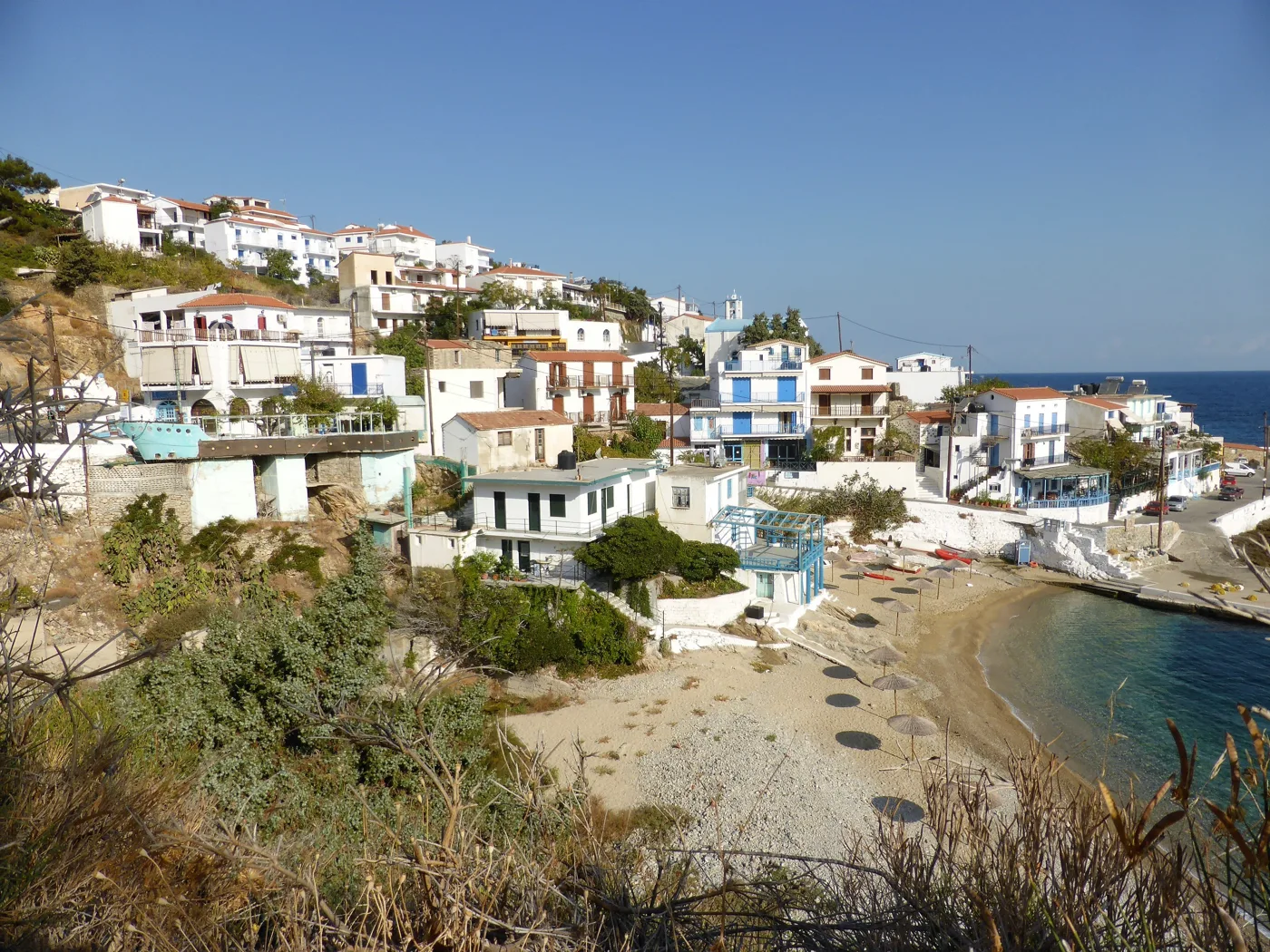
The village with the beaches of the north.
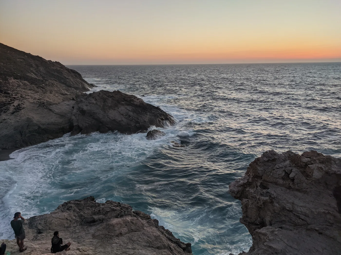
Sunset on the north coast.
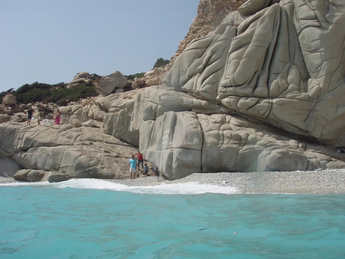
White rocks and turquoise water.
Photos: Rosa-Maria Rinkl (CC BY-SA 4.0), Leeturtle (CC BY-SA 4.0), Kostas Limitsios (CC BY 2.0) · Wikimedia Commons
The biggest festivals take place in July and August, especially around 15 August. They start late in the evening and go on until dawn. The programmes are posted every summer in the cafés and villages.
🚶 Practical tips
- Book early: there are few places to stay, especially in August.
- Leave a margin: in strong winds, ferries change times or are cancelled. Don’t book an international flight on the same day you return from an island.
- Car or scooter: on the larger islands, Karpathos, Kythira and Ikaria, it is almost essential.
- Cash: in small villages and tavernas, cards are not always accepted.
- Shoes: on all the islands you will walk a lot, on footpaths and steps.
📅 When to go
May, June and September are ideal: warm sea, less wind and shops open. In July and August the meltemi blows, especially in the Cyclades and on Karpathos, and the few places to stay fill up. But it is also festival season. From November to March there are few ferries and many shops are closed.
⛴️ How to get there from Ioulianou 50
For ferries to Folegandros, Amorgos and Ikaria, go to Piraeus on Line 1 from Victoria to the end of the line. For flights to Karpathos, Kythira and Ikaria, take Line 1 to Monastiraki and then Line 3 towards the Airport. For Symi, fly or take a ferry to Rhodes and a small boat from there. For Kythira by ferry, travel by road to Neapoli. For all ferries from Piraeus, see our guide to ferries from Piraeus.
Frequently asked questions
Which is the easiest for a first time?
Symi, if you are already on Rhodes, or Folegandros, if you are travelling in the Cyclades. Both are small and easy without a car.
Which is best for hiking?
Amorgos, with its old footpaths between the villages. Ikaria and Karpathos also have beautiful mountain routes.
Can I combine two islands?
Yes, but choose neighbouring ones: Folegandros with Milos or Santorini, Amorgos with Naxos, Symi with Rhodes. Karpathos combines with Rhodes or Crete.
How many days do I need?
At least three to four days for each island, because getting there takes time. For Symi, one night after a day trip is enough.
— Kathy