🪪 The island at a glance
📍 Where it is
Milos is the southwesternmost of the large islands of the Cyclades, in the South Aegean. To the north are Sifnos and Serifos, to the east Folegandros and Sikinos. Just to the northeast, across a narrow channel, is little Kimolos, which you reach by ferry from Pollonia. Milos belongs to the volcanic arc of the South Aegean, like Santorini.
📍 Where Milos is
Milos lies in the western Cyclades, southwest of Sifnos and northwest of Folegandros. In red you can see the shape of the island, together with Kimolos to the northeast. Ferries leave from Piraeus.
🗺️ The map of the island
Milos is shaped like a horseshoe around a large, deep bay that opens to the northwest. At the far end of the bay is Adamas, the port. The eastern half of the island is lower and inhabited: here are Plaka, the main town, the villages with the syrmata, Sarakiniko, Pollonia and most of the beaches. The western half is mountainous and almost empty, with dirt roads, Profitis Ilias, the highest mountain, and Kleftiko at the southwestern tip.
🗺️ The map of Milos
Milos looks like a horseshoe around a large bay. The eastern half has the villages, the port and most of the beaches. The western half is wild, with Kleftiko at the southwestern tip. The green dashed line shows the Pollonia – Kimolos ferry. Tap each number to see what it is.
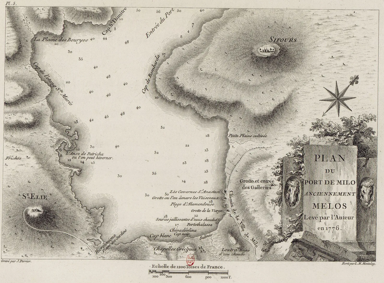
Map: Auguste de Choiseul-Gouffier, 1776 (CC BY-SA 4.0) · Wikimedia Commons
⚖️ Is it worth it? The pros and cons
Milos is for people who love the sea and landscapes. Here is an honest picture.
📊 At a glance, from 1 to 5
👍 The pros
- Some of the most distinctive coastlines in Greece: white, red and yellow volcanic rock.
- Dozens of beaches, so there is always one sheltered from the wind.
- The syrmata, the colourful fishermen’s houses right on the water.
- History: the Venus de Milo, catacombs, an ancient theatre, a Bronze Age town.
- A calmer atmosphere than Mykonos and Santorini.
👎 The cons
- Many roads in the western half are dirt tracks, and Kleftiko needs a boat.
- In August Sarakiniko and the syrmata get crowded.
- Prices are rising fast, and syrmata to stay in are expensive.
- Little shade on the beaches with white rocks.
- Mellow nightlife, few bars.
🌋 An island made by a volcano
Milos was born from volcanic eruptions, and you can see it everywhere: in the white rock of Sarakiniko, the multicoloured cliffs of Firiplaka, the hot springs and the sand warmed from below at Paleochori. Since prehistoric times people came here for obsidian, a black volcanic glass that cut like a knife and travelled all over the Aegean.
The minerals of Milos are still mined today, and the mines are still part of island life. In Adamas there is a Mining Museum that explains how the island’s earth became its wealth.
📜 A little history
On the north coast, Phylakopi was a Bronze Age town and one of the most important ports in the Aegean at the time. In the Classical period, in 416 BC, the Athenians besieged Milos, which wanted to stay neutral in the Peloponnesian War. Thucydides recorded their exchange in the famous “Melian Dialogue”.
In 1820 a farmer found in his field, near the ancient city below Plaka, the statue that became known as the Venus de Milo. Today it is in the Louvre, and there is a copy in the Archaeological Museum in Plaka. A little further down are the catacombs, one of the most important early Christian monuments in Greece: corridors carved into the rock with hundreds of tombs.
🏛️ Plaka, the catacombs and the ancient theatre
Plaka is the main town, built high above the bay. It is a white Cycladic village with narrow alleys, little shops and two museums, the Archaeological and the Folklore Museum. From the Kastro at the top of the hill and from the church of Panagia Korfiatissa, you see one of the finest sunsets in the Cyclades, over the bay.
From Plaka and Trypiti a road runs down towards the sea. On the way are the catacombs and the ancient theatre, Roman, with marble seats and a view over the whole bay. A small sign marks the spot where the Venus was found. At the end of the road is Klima.
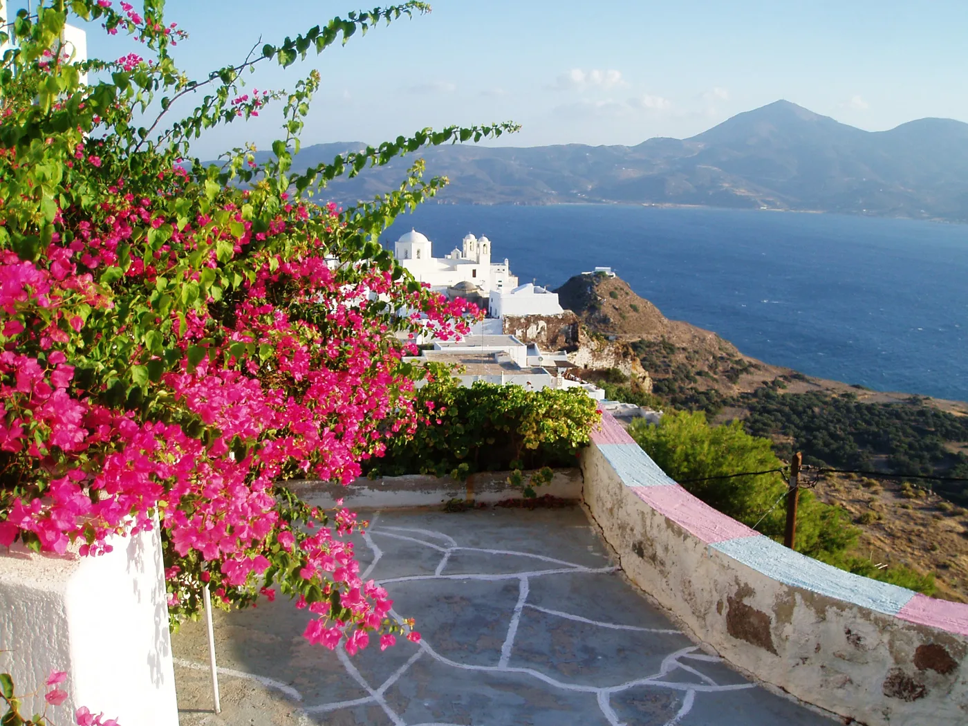
The main town, high above the bay.
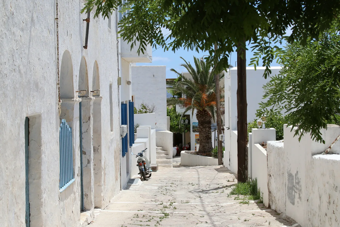
White houses and quiet.
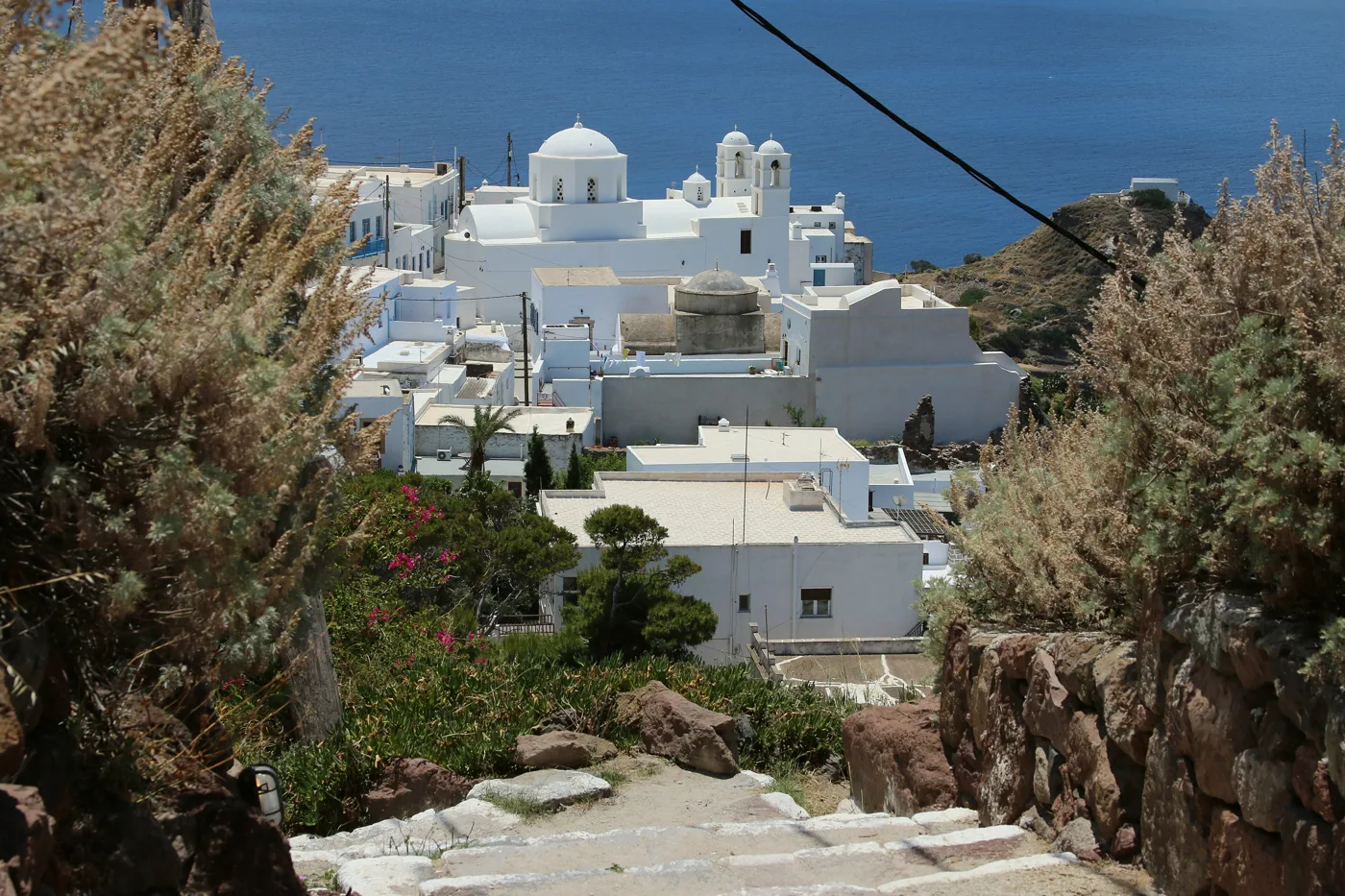
The best-known sunset view.
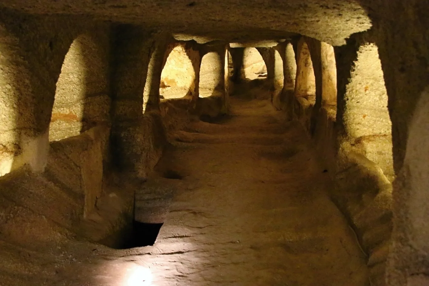
Early Christian tombs carved into the rock.
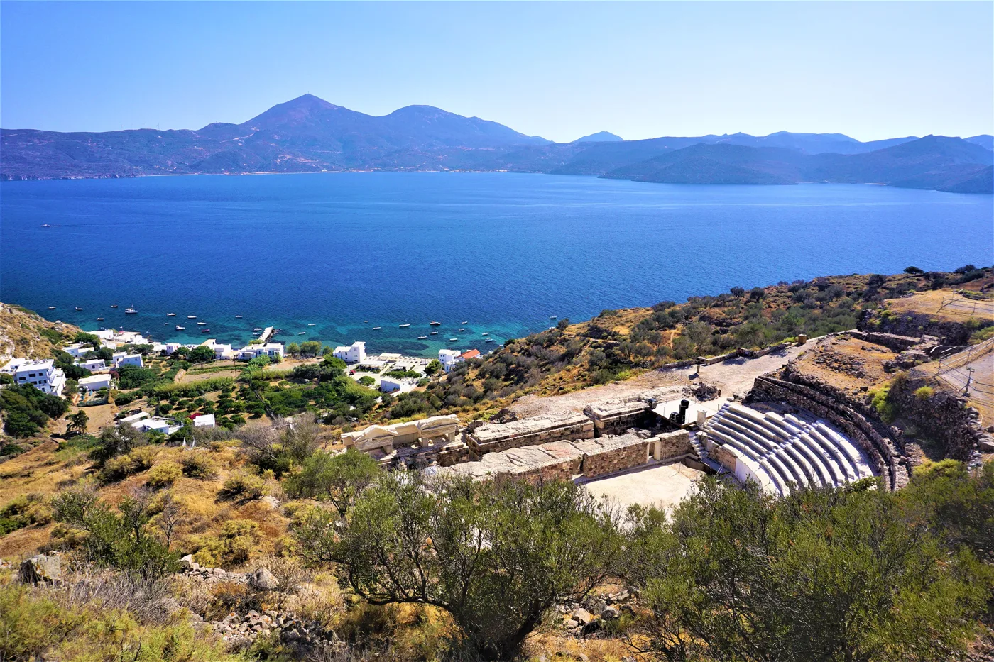
Marble seats with a view of the bay.
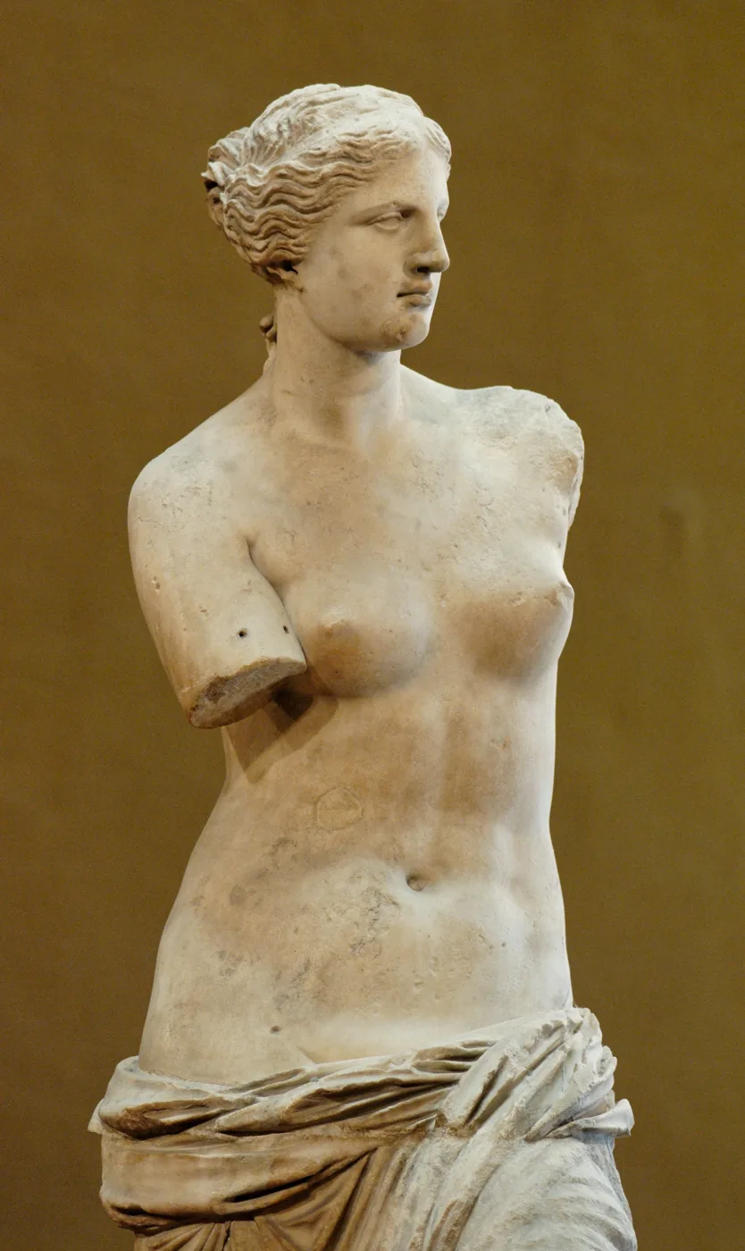
Found here in 1820, now in the Louvre.
Photos: Enough4unow (CC BY-SA 4.0), Zde (CC BY-SA 4.0), Joyofmuseums (CC BY-SA 4.0), Musée du Louvre (Public domain) · Wikimedia Commons
🏘️ The syrmata: Klima, Mandrakia, Firopotamos
The syrmata are the symbol of Milos: fishermen’s houses built right on the water, with a garage for the boat on the ground floor and a room above. The doors are painted in bright colours. The best-known village with syrmata is Klima, below Plaka. Many syrmata can now be rented for a stay.
On the north coast, Firopotamos is a small bay with a few syrmata and a chapel on the rock, lovely for a swim. Mandrakia, a little further east, is a fishing hamlet with a tiny harbour and a taverna. Further east still, Pollonia is a quiet fishing village with tavernas and the ferry to Kimolos.
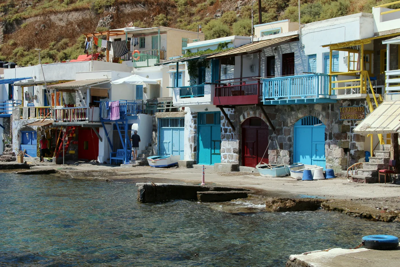
Fishermen’s houses with boat garages.
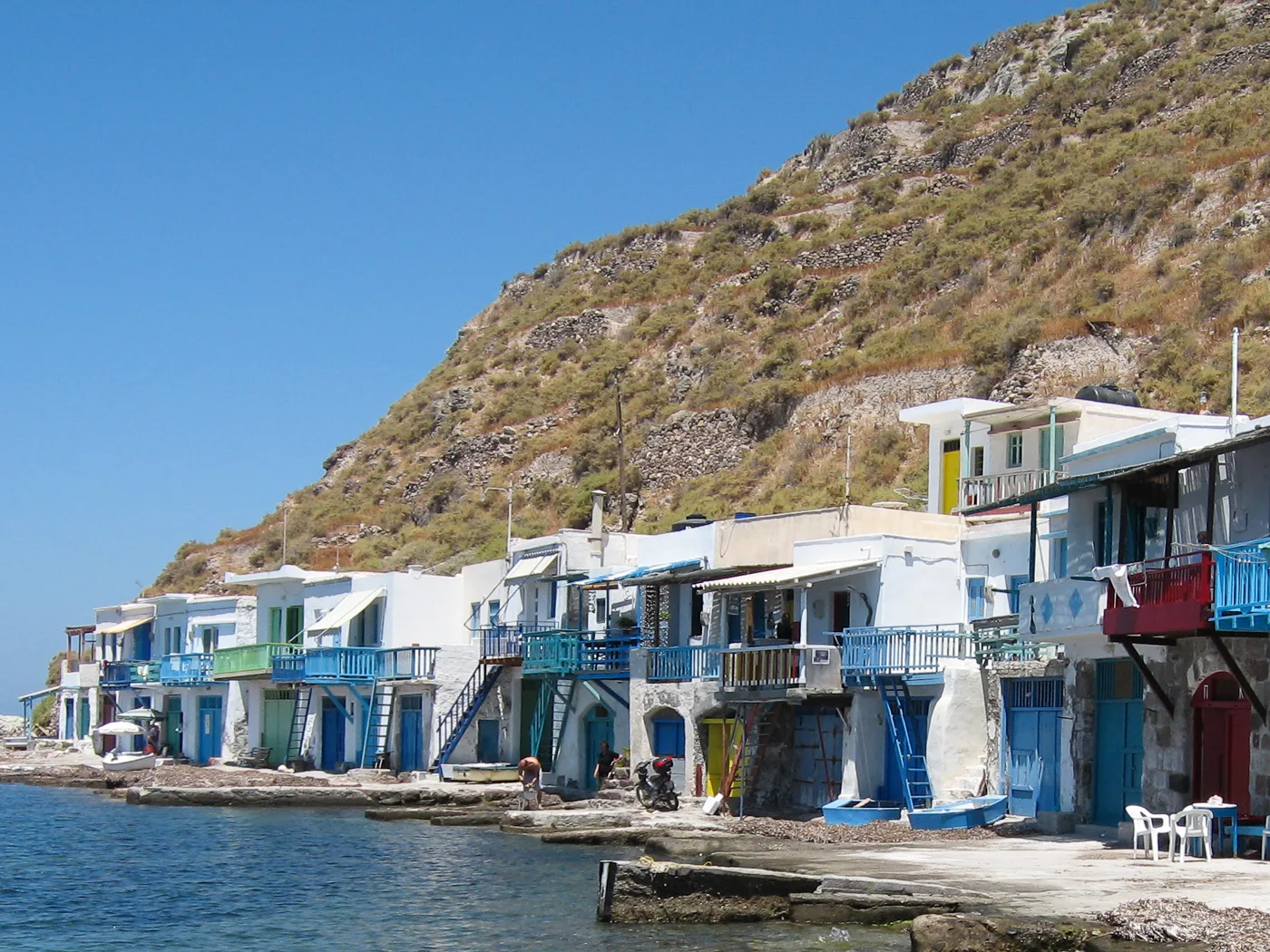
Every door a different colour.
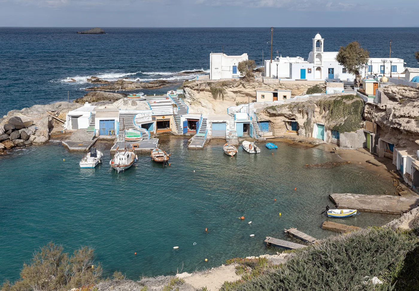
A fishing hamlet on the north coast.
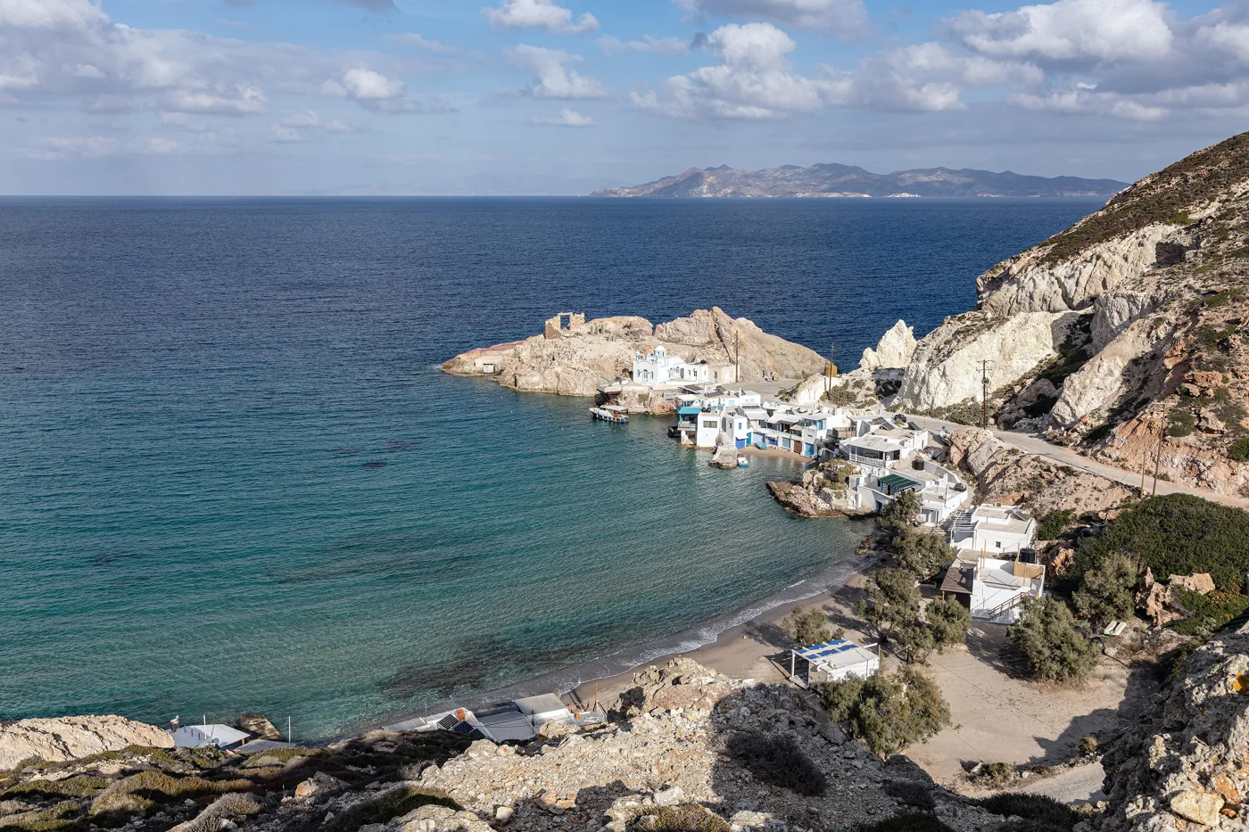
A bay for swimming, with syrmata around it.
Photos: Zde (CC BY-SA 4.0), Oliwan (CC BY-SA 3.0), Manfred Werner – Tsui (CC BY-SA 4.0) · Wikimedia Commons
⚪ Sarakiniko and the north coast
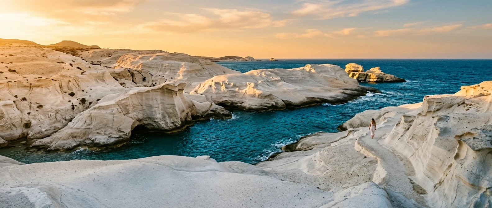
Sarakiniko is the most photographed image of Milos: white volcanic rocks carved by wind and sea into soft curves that look like a lunar landscape. Between them runs a narrow channel of turquoise water. There is no shade. Go early in the morning or at sunset, and do not swim when the north wind blows, because the waves hit the rocks hard.
Further east, Papafragas is a narrow cleft between high rocks, like a little fjord, with a small beach at the bottom. Right next to it are the ruins of Phylakopi, with a Mycenaean wall above the sea.
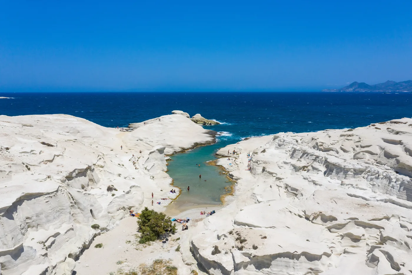
A lunar landscape of white rock.
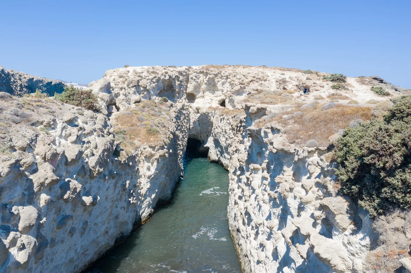
A cleft in the rock with the sea inside.
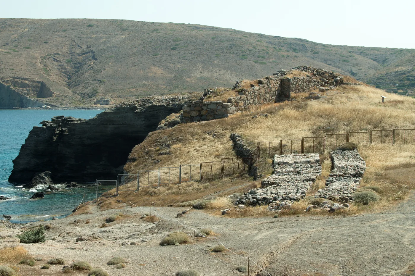
A Bronze Age town on the north coast.
Photos: dronepicr (CC BY 2.0), Zde (CC BY-SA 4.0) · Wikimedia Commons
⛵ Kleftiko and the south coast
Kleftiko, at the southwestern tip, is a cluster of white rocks rising from the sea, sea caves and arches, with water in every shade of turquoise. The name recalls that it was a pirates’ hideout. You can only reach it from the sea: by boat from Adamas or Pollonia, usually on a full-day trip, or on foot in about two hours. The boats also stop at other caves and coves on the west coast.
The south coast has some of the best beaches on the island, ideal when the meltemi blows:
- Firiplaka: a large sandy beach below cliffs in red, white and ochre.
- Tsigrado: a small cove with turquoise water. You climb down with a rope and a wooden ladder inside a cleft in the rock.
- Paleochori: a large organised sandy beach with tavernas. In places the sand and water are warm from the volcano.
- Agia Kyriaki: a quiet sandy beach with shallow water, good for families.
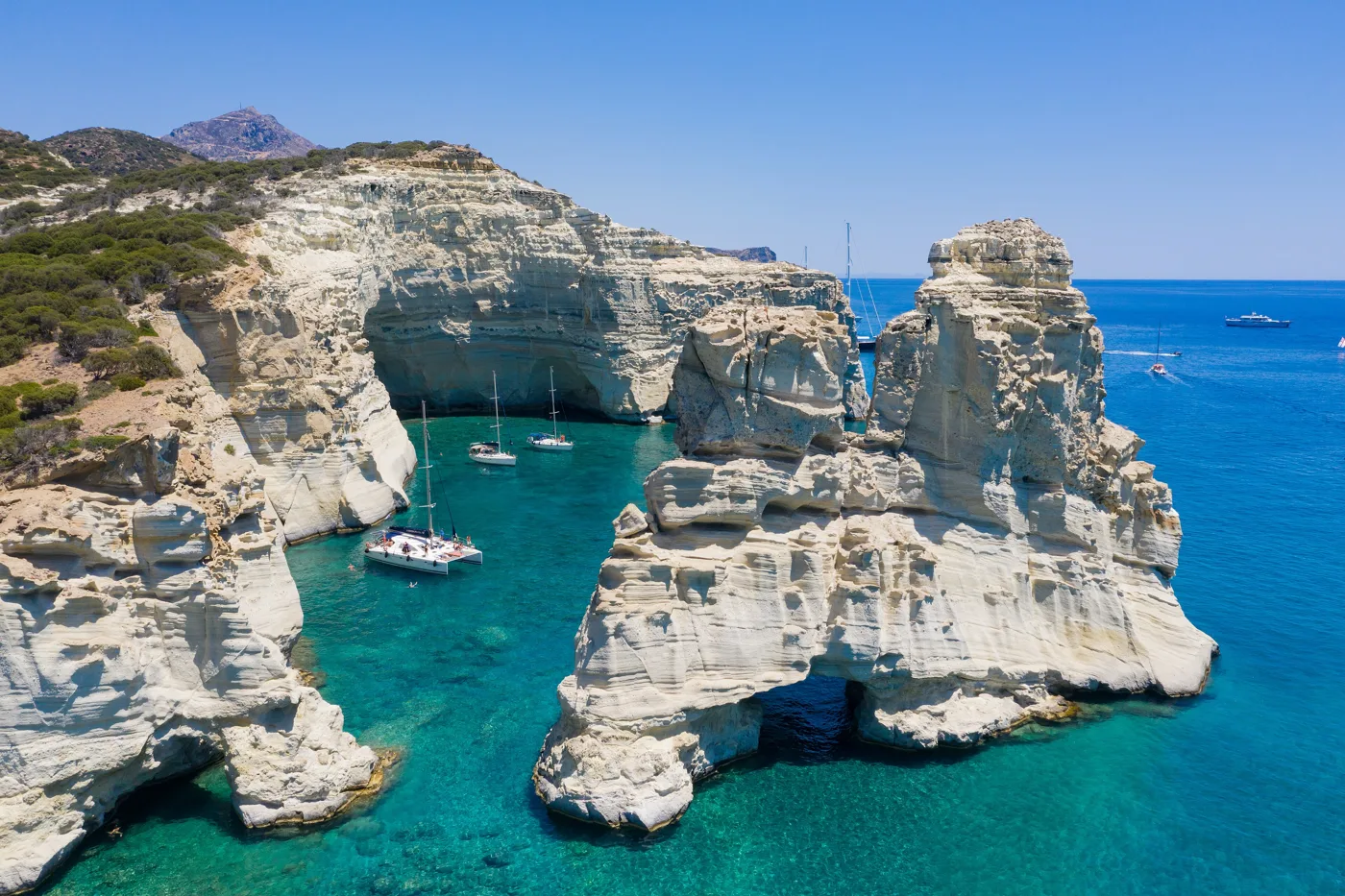
Rocks and caves, only from the sea.
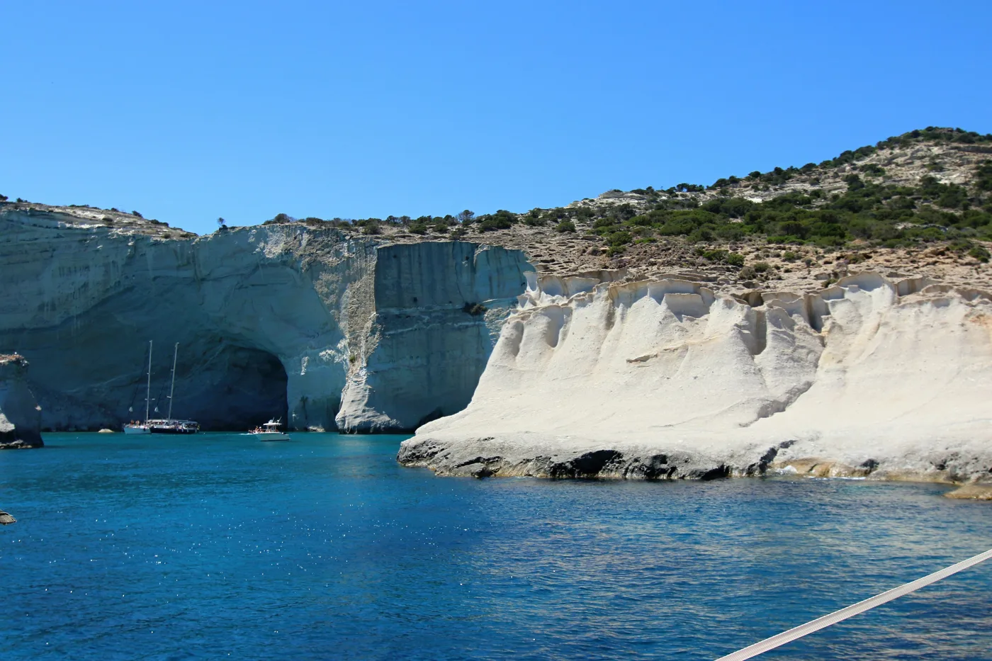
The old pirates’ hideout.
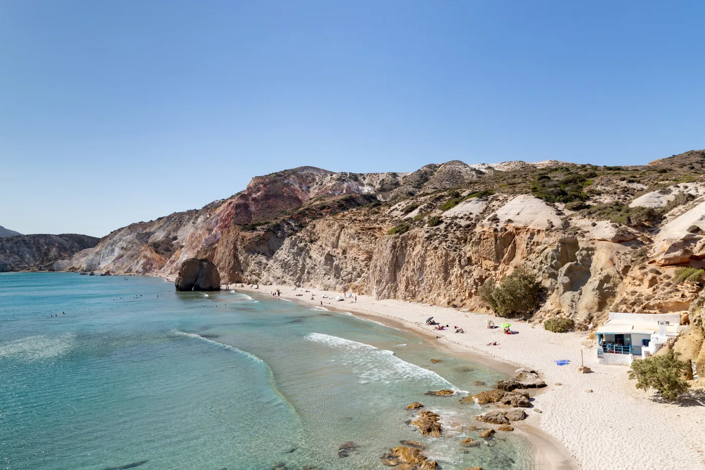
Cliffs in red, white and ochre.
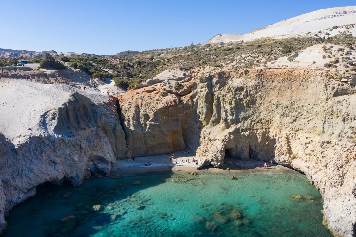
You climb down with a rope and a ladder.
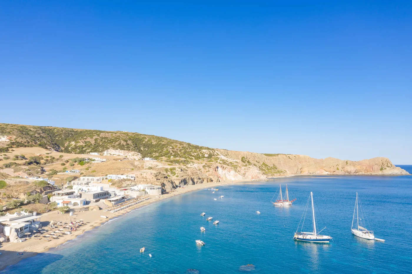
Sand warmed by the volcano.
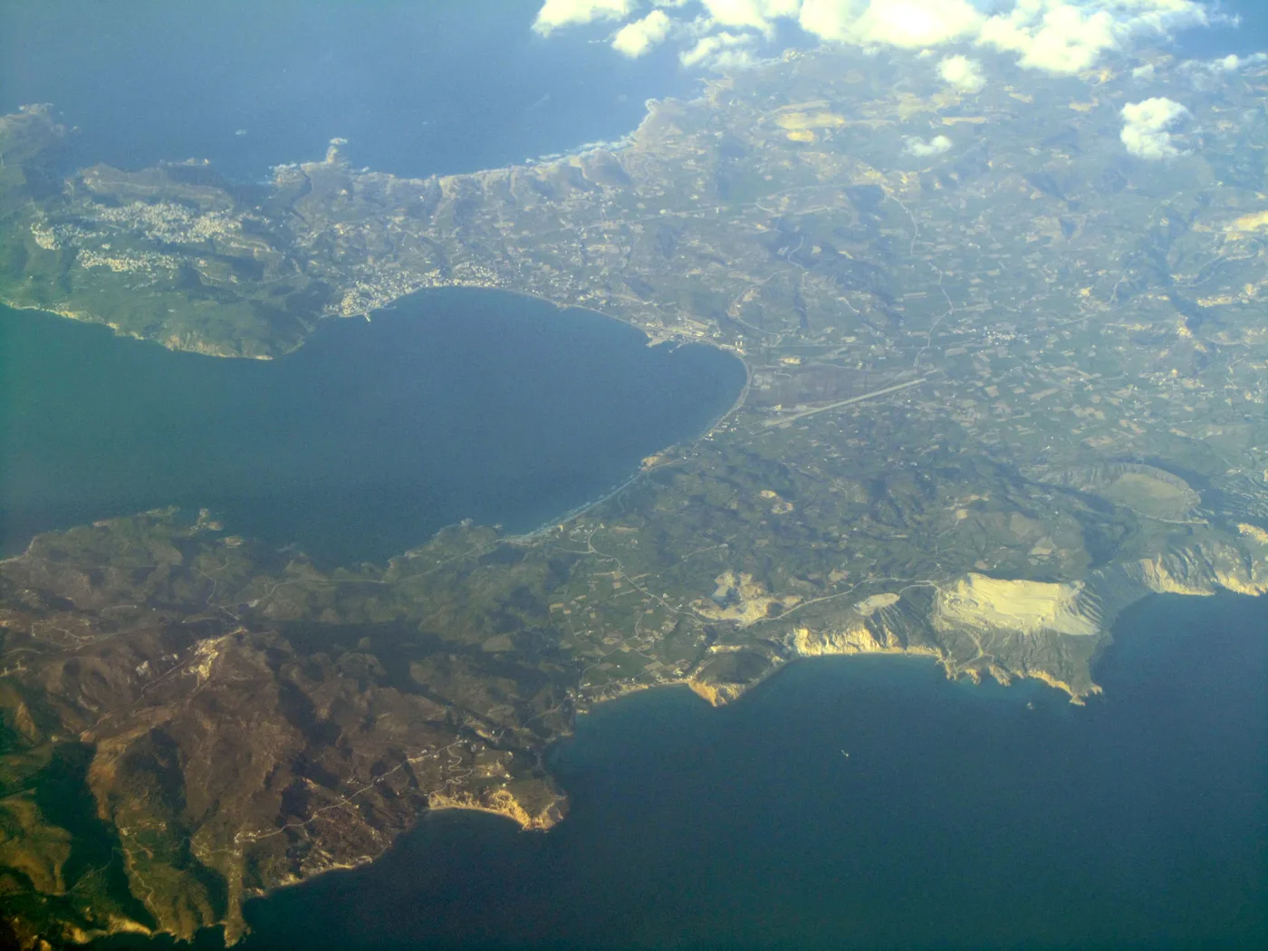
The horseshoe around the bay.
Photos: dronepicr (CC BY 2.0), Zde (CC BY-SA 4.0), RThiele (CC BY-SA 3.0) · Wikimedia Commons
A ferry leaves Pollonia for Kimolos and takes about half an hour. It is a small, quiet island with an old castle village, windmills and uncrowded beaches. The perfect break from Milos in August.
🍽️ What to eat
On Milos try pitarakia, little fried cheese pies, karpouzopita, a sweet made with watermelon and honey, and fresh fish in the tavernas of Klima, Pollonia and Adamas. Plaka has some of the best restaurants on the island, with a view of the sunset. For a drink, the bars of Adamas and Plaka are relaxed, with no clubs.
📅 When to go
The best time is June and September: the sea is warm and boats to Kleftiko run every day. In July and August Sarakiniko and the syrmata fill up, and the meltemi can cancel boat trips. May and October are lovely for hiking and photography, but the sea is cooler.
When the north wind blows, swim on the south coast: Firiplaka, Tsigrado, Paleochori. When the south wind blows, choose the north: Sarakiniko, Firopotamos, Papafragas. Check the forecast every morning before you choose a beach.
⛴️ How to get there from Athens
| How | Duration | From | Notes |
|---|---|---|---|
| 🚤 Fast ferry | 2.5–3.5 hours | Piraeus | The fastest, it rolls when the wind blows. |
| ⛴️ Conventional ferry | 4–7 hours | Piraeus | Cheaper, with stops at other islands. |
| ✈️ Plane | About 40 minutes | Athens airport | A small airport a few minutes from Adamas. |
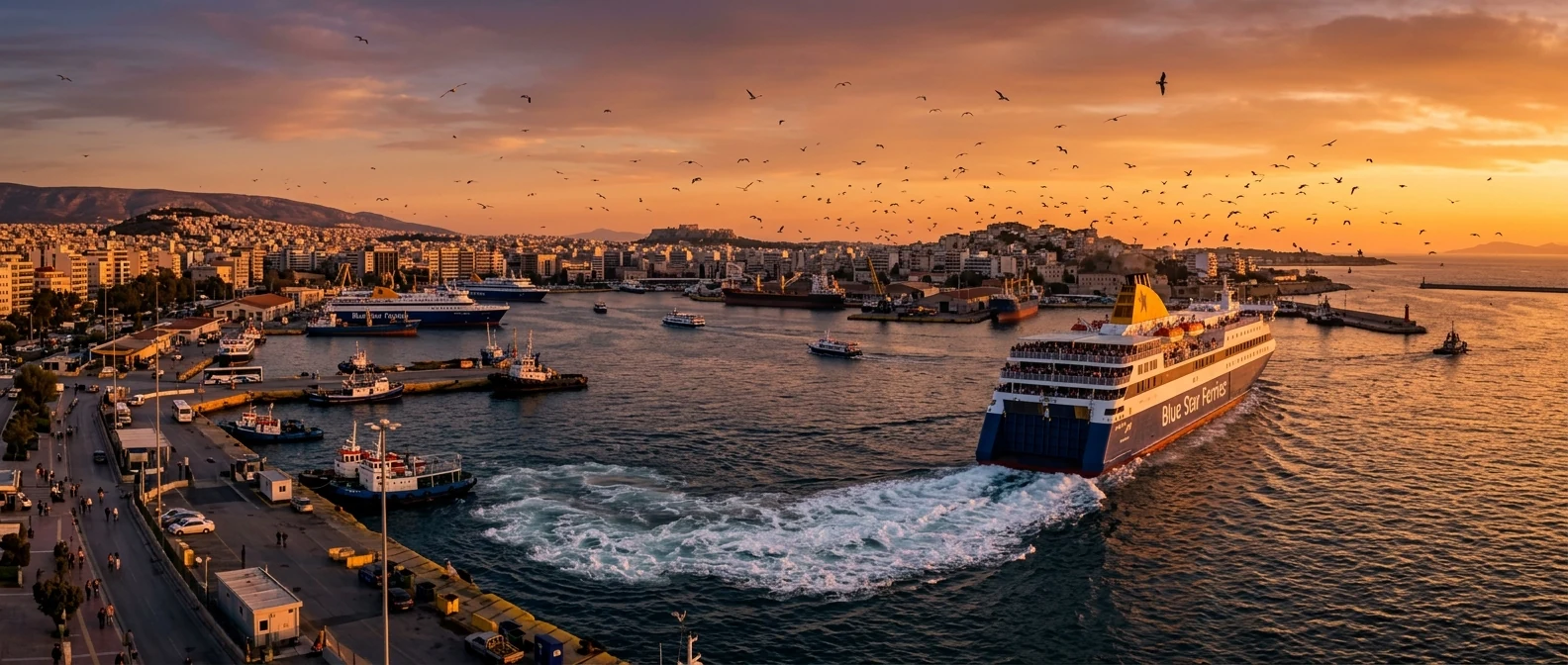
From Ioulianou 50, Piraeus is easy: Line 1 from Victoria to the end of the line, no changes. For the airport, take Line 1 to Monastiraki and then Line 3 towards the Airport. Ferries arrive at Adamas, at the far end of the bay. See our guide to ferries from Piraeus.
🚌 Getting around the island
- KTEL buses: from Adamas to Plaka, Trypiti, Pollonia and some south coast beaches. There are few services, so check them in advance.
- Car: the best way to see the island. Many beaches have a dirt track at the end, and for the western half a 4x4 helps.
- Quad or scooter: popular, but watch out for dirt tracks and dust.
- Boats: to Kleftiko and the caves of the west coast, from Adamas and Pollonia.
🛏️ Where to stay
| Region | For whom | Good to know |
|---|---|---|
| Adamas | No car, first visit | Port, buses, restaurants, a central location. |
| Plaka, Trypiti | Couples, views | Quiet, with sunsets over the bay. |
| Pollonia | Peace and quiet, families | A fishing village with tavernas, close to Kimolos. |
| Syrmata at Klima or Firopotamos | A special experience | Expensive and few, book very early. |
| Paleochori, south coast | Beach | Far from the villages, you need a car. |
🗓️ A three-day itinerary
Plaka, the catacombs, Klima and the sunset
Morning at the catacombs and the ancient theatre, then down to Klima for the syrmata. Midday swim at Firopotamos. In the afternoon go up to Plaka and watch the sunset from Korfiatissa or the Kastro.
A boat to Kleftiko
A full-day cruise from Adamas or Pollonia: Kleftiko, caves and coves that only boats can reach. Dinner in Pollonia or Adamas in the evening.
Sarakiniko, the north and south coasts
Sarakiniko early in the morning, before the crowds, then Mandrakia, Papafragas and Phylakopi. In the afternoon cross to the south coast for Firiplaka, Tsigrado or Paleochori, depending on the wind.
Frequently asked questions
How many days do I need?
At least four, so you have room for the Kleftiko trip if the wind postpones it. With a week you also have time for Kimolos.
How do I get to Kleftiko?
By boat from Adamas or Pollonia, usually on a full-day trip with swimming stops. There is also a footpath of about two hours, but you need to be fit and carry water.
Do I need a car?
Yes, if you want to see the beaches. Buses are few and do not reach many places.
Is it good for children?
Yes, if you choose sandy beaches such as Agia Kyriaki, Paleochori and Firiplaka. Sarakiniko and Tsigrado need care.
Where is the Venus de Milo?
In the Louvre Museum in Paris. In the Archaeological Museum in Plaka you will see a copy, and near the ancient theatre the spot where it was found.
— Kathy